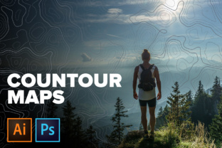
Contour Maps Topographic
Contour Maps Topographic aren’t geographic tools—they’re visual storytelling devices. These aren’t maps of real mountains or valleys, but stylized, hand-crafted vector illustrations built from clean, rhythmic contour lines. Each one evokes the essence of elevation, terrain, and spatial depth—without needing GPS coordinates or survey data. They’re designed to add dimension, structure, and subtle narrative weight to digital and print work.
Why a “Fake” Topographic Map Might Be Exactly What You Need
Real-world topographic maps serve precise functional roles: navigation, land management, engineering planning. But creative work often calls for something else—a mood, a rhythm, a sense of groundedness or exploration. That’s where these Contour Maps Topographic shine. They suggest movement across terrain without demanding accuracy. They imply scale and perspective while staying abstract enough to adapt.
Think of them like musical notation for landscape: not a recording of a place, but a score that invites interpretation. A designer might layer one beneath text to imply journey or growth. An educator could use it as a neutral, non-distracting background during a climate science presentation. A small business owner launching an outdoor gear line might use one as a textured backdrop in a product banner—evoking adventure without clichéd pine trees or stock hikers.
For Designers & Creatives
If you work with branding, web layouts, or editorial design, flexibility matters more than fidelity. These Contour Maps Topographic come as editable Illustrator files—so you can shift hues to match brand palettes, adjust line weight for hierarchy, or isolate individual contours for animation. The included JPGs offer quick drag-and-drop usability for mockups or social posts where vector support isn’t needed. Since they’re 2000×2000px at 72dpi, they scale cleanly across most screen-based contexts—no pixelation, no fuss.
For Educators & Presenters
Visual metaphors help learners grasp abstract ideas—like data gradients, system layers, or progressive change. A contour map can represent rising complexity in a curriculum, tiers of customer support, or even emotional development stages. Because these maps avoid literal geography, they sidestep cultural or regional assumptions (no disputed borders, no unfamiliar landmarks). And because color is fully editable, you can align them with accessibility standards—boosting contrast for low-vision audiences or switching to colorblind-safe schemes.
For Marketers & Small Business Owners
You don’t need realism to build resonance. A wellness studio might use a soft-blue contour map behind a “Journey to Balance” headline. A tech startup explaining layered architecture could fade one into the background of a slide—subtly reinforcing concepts like foundation, elevation, and interdependence. Unlike generic textures (concrete, linen, noise), these carry quiet meaning: structure, progression, groundedness. And because they’re non-repeating—not seamless patterns—they feel intentional, not wallpaper-like.
For Hobbyists & DIY Enthusiasts
Maybe you’re making custom notebooks, laser-cut coasters, or embroidered patches. These maps translate beautifully across mediums. Print one on kraft paper for a rustic journal cover. Import the vector into Cricut Design Space to cut delicate contour-line stencils. Convert a JPG to a fabric print via Spoonflower. No licensing hurdles—these are ready for personal and commercial use alike, as long as you’re not reselling the files themselves.
What Makes These Contour Maps Topographic Practical—Not Just Pretty
Five distinct color schemes mean you’re not locked into one aesthetic. One might lean earthy (ochre, charcoal, slate), another cool and minimal (steel, mist, ivory), another vibrant and modern (teal, coral, warm gray). All five vectors are built in Illustrator CC using native paths and groups—not raster effects or embedded images—so every stroke, fill, and layer stays responsive to edits.
That editability changes how people approach them:
- Beginners appreciate that they can start with a finished look—no drawing skills required—and still tweak colors or crop composition in seconds.
- Experienced users value the clean anchor points and logical layer naming—making it easy to extract sections, animate paths, or integrate with generative tools.
- Freelancers save time: instead of building terrain from scratch for each client, they drop in a base map and refine it to match project tone.
When This Collection Fits—And When It Doesn’t
This set works best when you want implied terrain—not literal geography. If your project needs labeled elevations, coordinate systems, or GIS integration, these won’t help. They also aren’t seamless, so tiling them edge-to-edge will show visible breaks. That’s intentional: these are meant as singular compositional elements, not infinite backgrounds.
They’re especially useful if any of these apply:
- You’re building a visual identity around ideas like growth, discovery, or layered thinking.
- You need high-resolution, scalable assets that stay crisp on retina displays and printed materials up to ~8×8 inches.
- You prefer working with layered, organized vectors rather than flattened PNGs or JPEGs with locked transparency.
- You want consistency across multiple touchpoints (e.g., same contour motif used in a website banner, presentation deck, and event signage).
Conversely, if you’re producing hiking trail guides, municipal planning documents, or geospatial dashboards—look elsewhere. These Contour Maps Topographic prioritize expressive utility over technical precision.
A Final Thought: Texture With Intention
In a world saturated with generic stock assets, thoughtful texture stands out. These maps don’t shout. They settle in—supporting content without competing with it. They give designers room to breathe, educators room to clarify, and creators room to reinterpret. Whether you’re sketching wireframes, prepping a lecture, or designing packaging for a new herbal tea blend, a well-placed contour line can quietly say: *this matters, this has depth, this unfolds over time.*
No expertise required. No steep learning curve. Just five starting points—each editable, each distinct, each waiting to take on the meaning your project needs.